
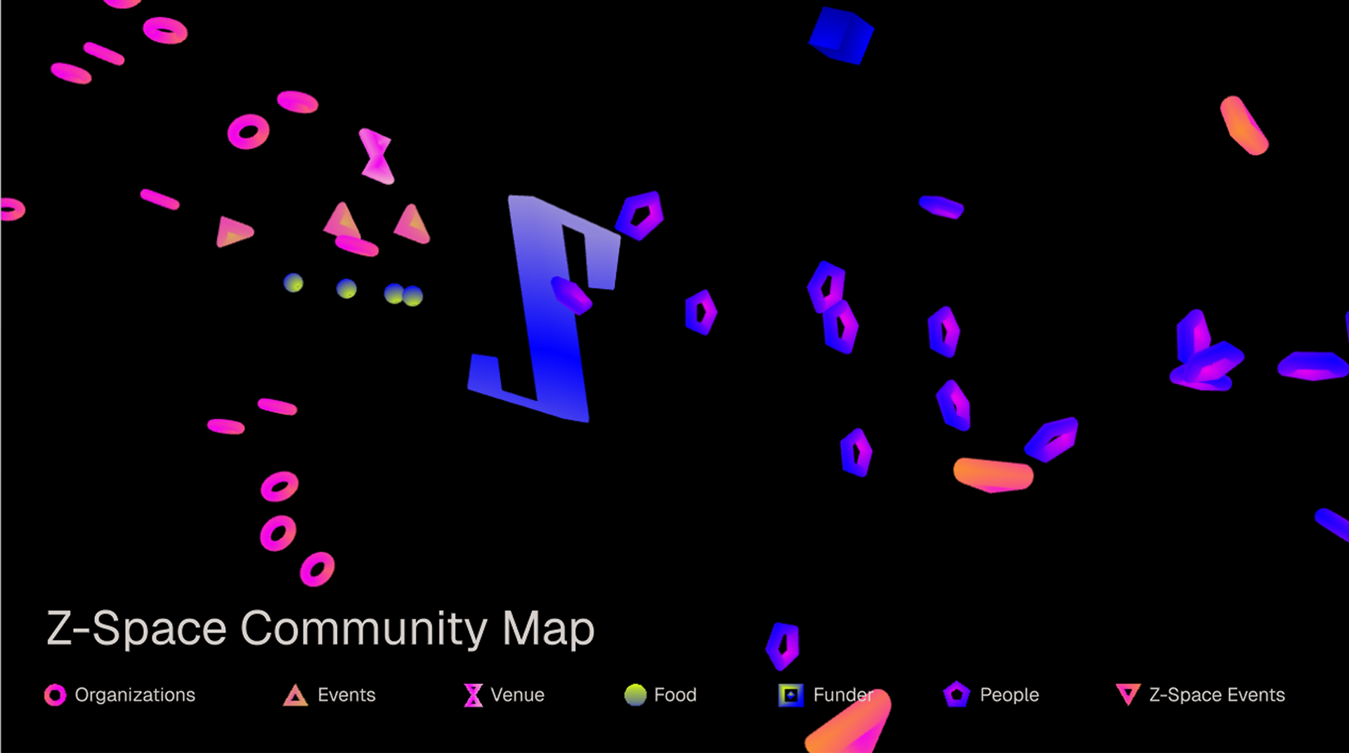
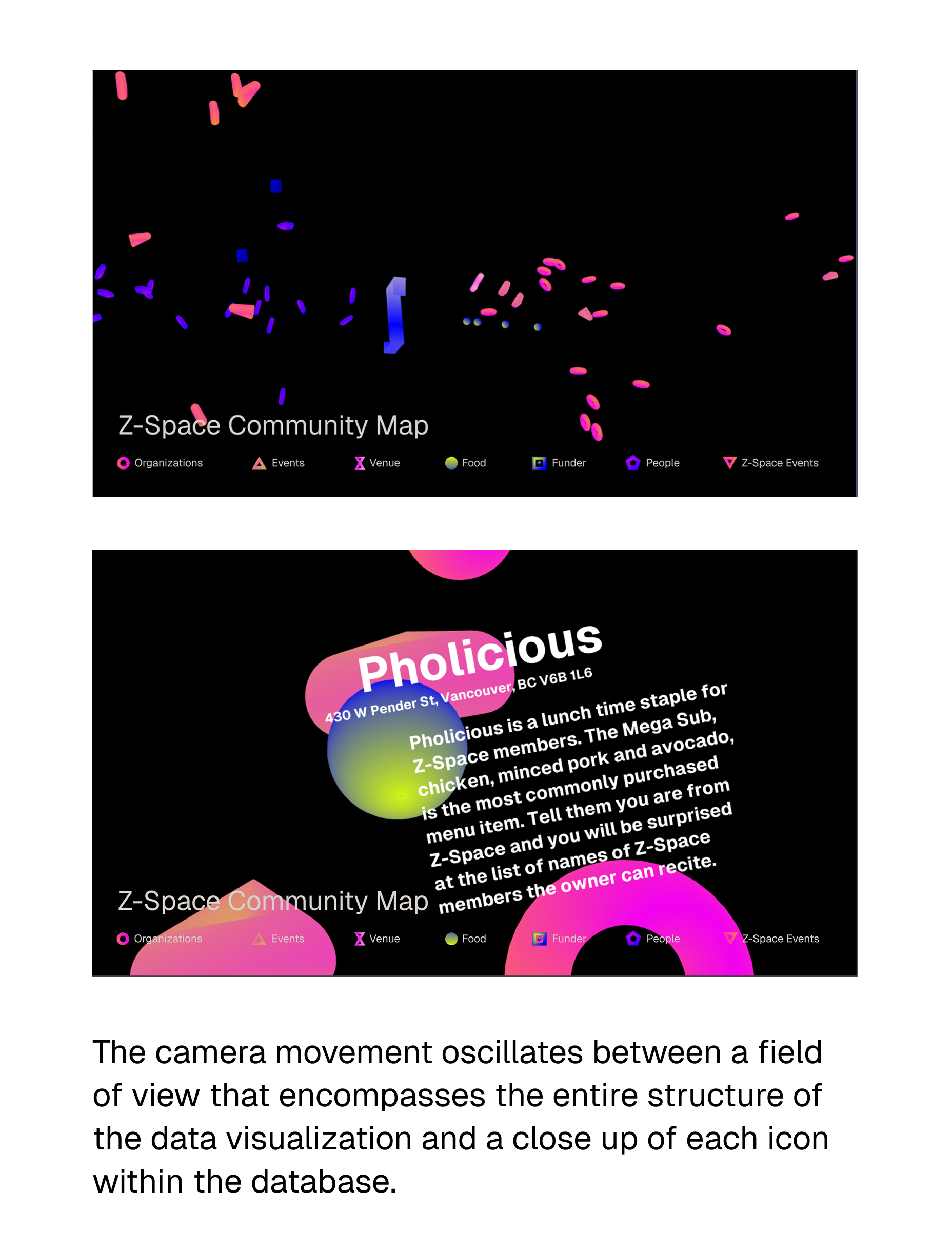
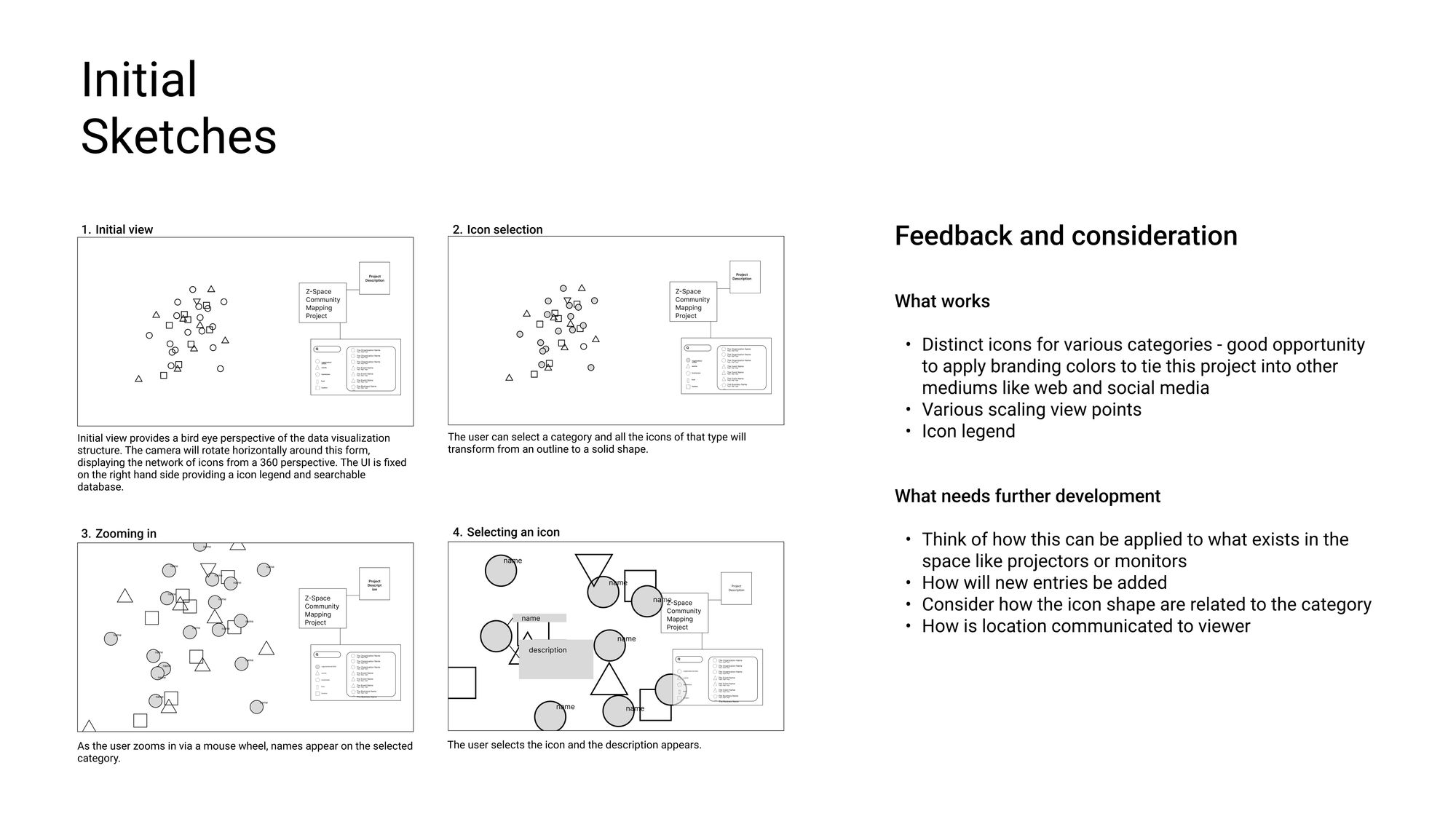
The Z-Space Community Mapping Project is a data visualization highlighting the internal and external people, places and things that shape, influence and sustain Z-Space.
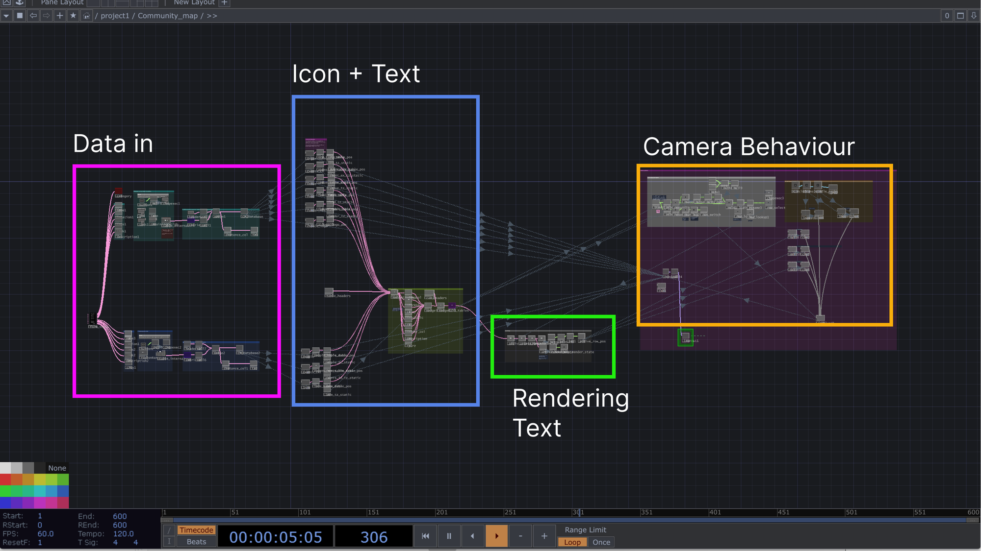
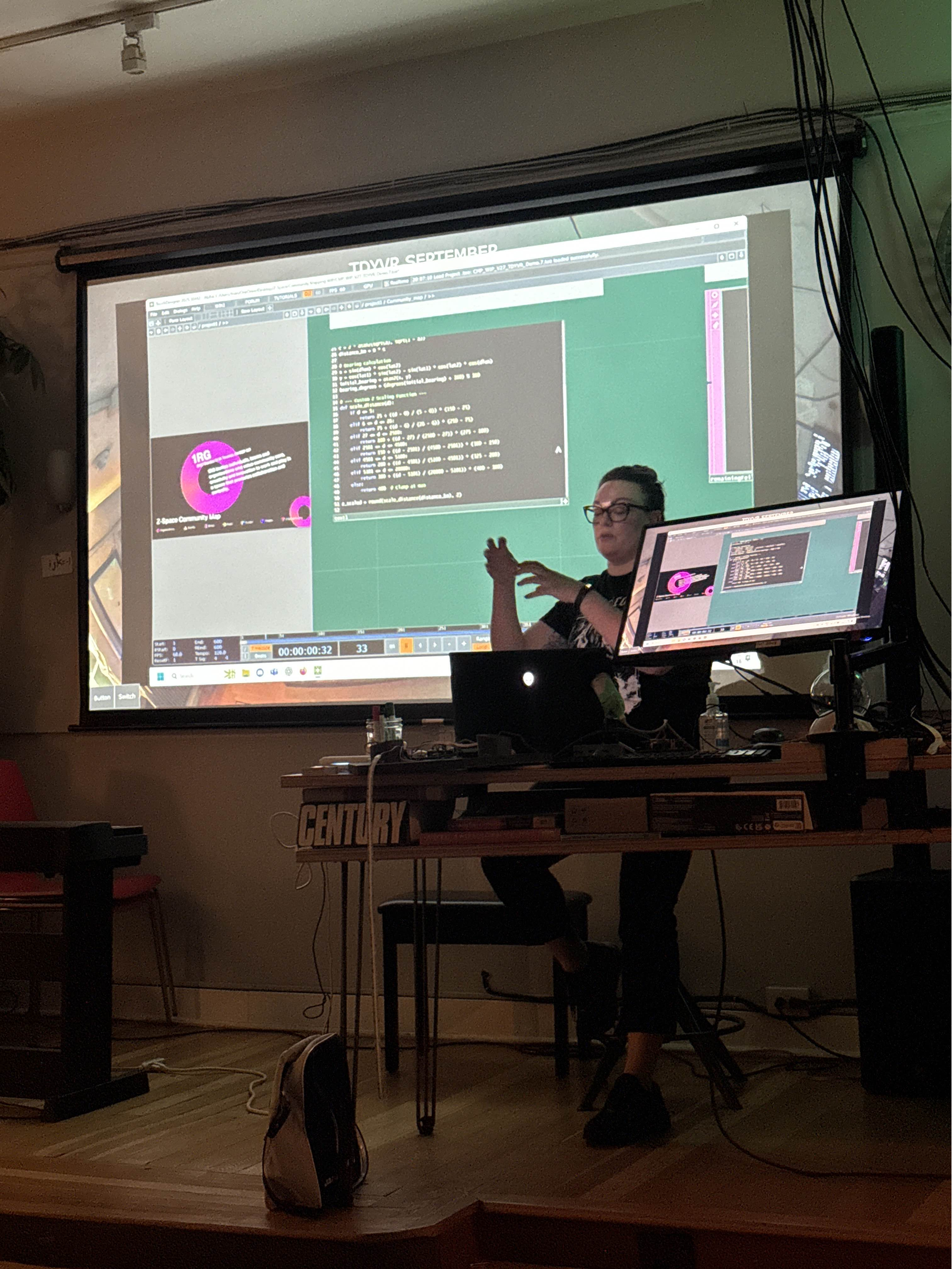
This project was developed over the summer by Triane Tambay, Events & Space Coordinator and co-op student from SFU’s School of Interactive Arts and Technology. Her goal was to create a digital artifact for Z-Space that reflects the broad community the space is embedded within. Built in TouchDesigner, a node-based visual programming environment, the work takes the form of a screen-saver-like data visualization. It maps external categories such as organizations, events, venues, food, and funders alongside internal categories, including the people and activities emerging directly from Z-Space.

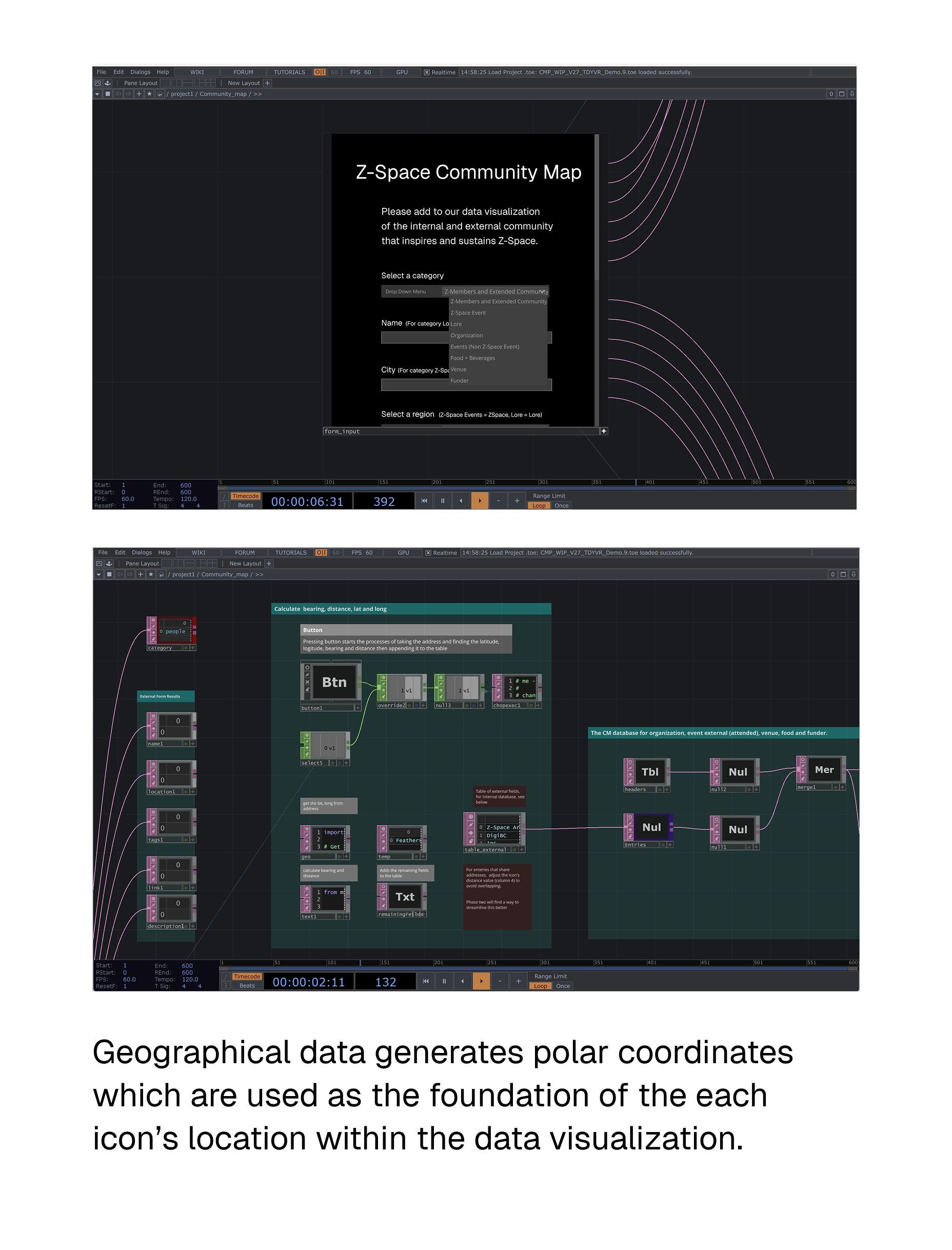
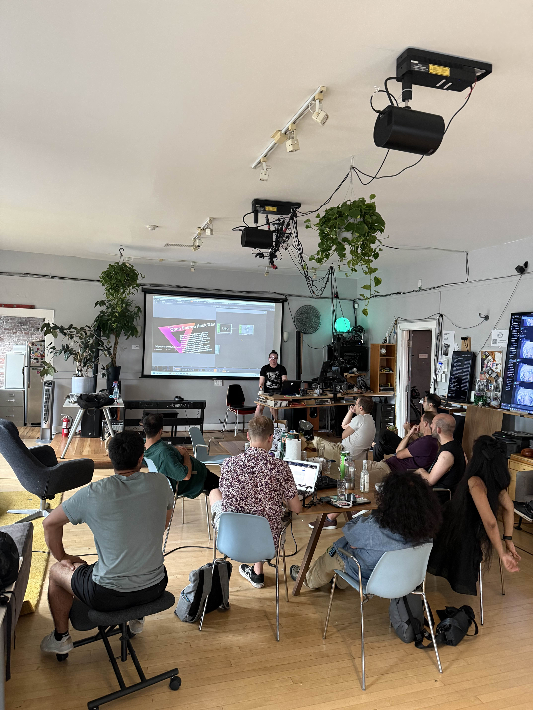
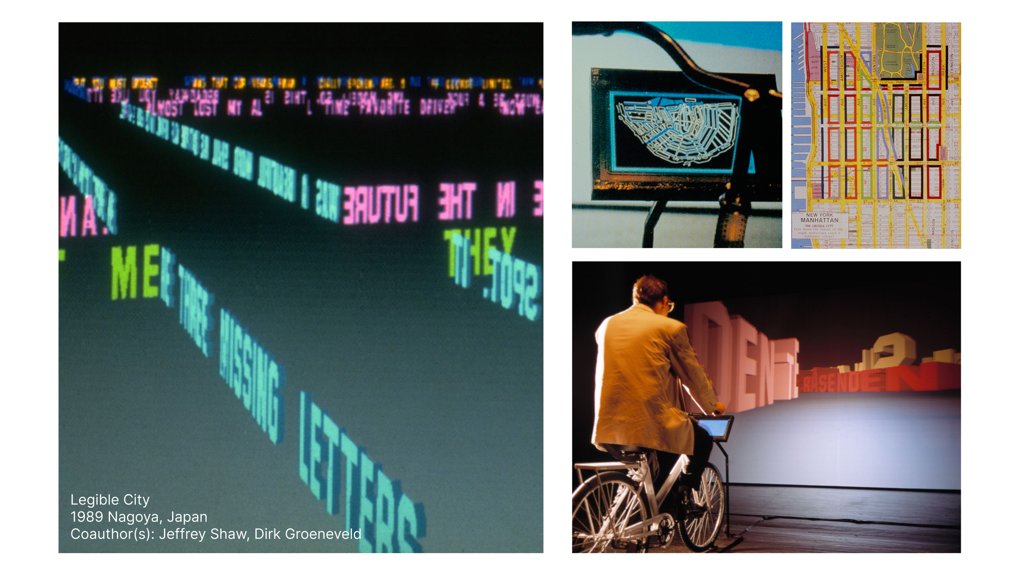
The Community Mapping project was presented to Z-Space members and at the September TDYVR meetup, where Triane highlighted her workflow, inspiration and process. Inspired by pioneers within media arts who used real world data to map digital environments, like Jeffery Shaw's 1989 Legible City, Triane grounded her project in how geographical data like street address, provinces and countries, can be abstracted to provide the data visualization structure. Routed in a sense of real word scale, the Z-Space logo acts as a point of origin where external categories scatter across the positive z-axis and internal categories are placed along the negative z-axis.
Triane would like to thank Jonny, Boris, Pouria, Ian and Vaden for all their support in creating this project.
Want to be added to our Community Map? Let us know!